
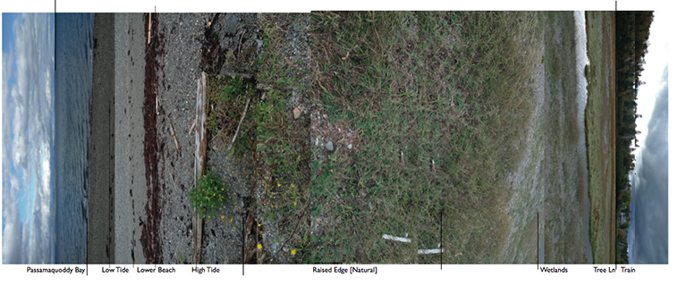
St. Croix River – Passmaquoddy Bay
Graduate Studio 2009 Mapping Boundarylines:
Maine & New Brunswick Border
Description: Detailed Observation and Basic Categorization of generalized patterns, irregularities and underlying structures of the systems at work in the areas studied. Natural/Infrastructural, Built/ Water, Water/Land, Forest/ Wet lands, etc. In understanding these edges their breath and directionality students were asked produce documentations and interpretive models. Measurement maybe approximate, but is verified through Mappings and previous research, climate, cycles(seasons, tidal).
 Students:
Josh Collins
Becky MacKenzie
