The design for the New Rochelle site (1-5) is inspired and based on a deep understanding of context and the underlying factors that have shape and continue to influence it. The scheme brings together and overlays the various past and existing conditions, forces and histories (both cultural and natural) that make-up the site and its’ context. In this way, our vision creates a process that is inclusive and sees building as an enabler that both frames and mediates between the layered processes ‘of becoming’, setting futures as part of a much longer timeline that enable both humans and the natural landscape of the site to exist within a balanced continuum. This text and the design for the site, sit between the two main forces/lines, the cultural (human) and natural landscapes. It attempts to mediate and facilitate the linkage of ecologically and urban forces; with their past and present histories.
Natural and Cultural Landscapes
The landscape context of the site (1-5) is analyzed revealing both directionality and the force(energy) that have shaped it through the centuries these operate at both scales of the regional and the site and can be categorized through geology and watersheds as well as the existing and latent surface patterns(edges, patches/areas and corridors) and topographies (historical and present).
Geology: The deep scaring of the rock surface formed by ice age retreat caused ridges and deep directional cuts in the surface, creating pockets where water can infiltrate, and the edge dynamic of place.
Water Sheds: The sites are low-lying (1-5). Sites 1 and 2 sit at the confluence of two creeks/streams, which shaped the drainage and accumulation of silt within pockets of the low land which run perpendicular to the coastline and the geological formation of the rock beneath its surface.
The directionality of systems Water and Stone structures create a unique quality and tectonic of place that is picked up by the proposed design of the landscape and building and is grounded in the origin of the settlement at the confluence between freshwater and ocean; rock edge and shallow bays. This crossing can be seen in how humans have inhabited this same edge (piers, break walls and inlet structures) that enable the ebb and flow of sweet and saltwater to flow, infiltration and retreat across its structured surface. This then is the bases for the design scheme as a mediating landscape, that pairs much needed Water Infrastructure and Public Facilities as the base of development on Long Island Sound.
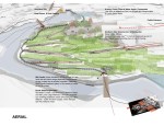
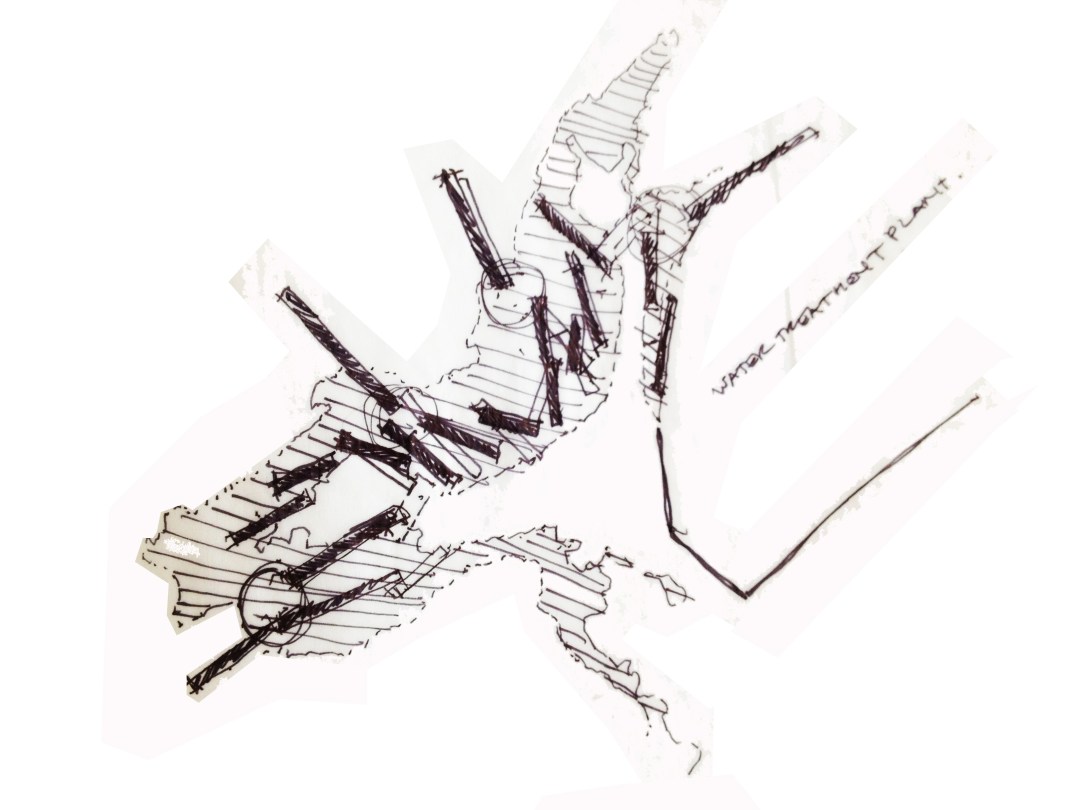
Water Infrastructure paired with Public Facility
Using old infrastructures (french drain, dikes and bridges(locks)), the scheme embeds the landscape with waterfront mitigation infrastructure and cultural community through linking scales and cycles, from human habitation to infrastructure and hydrological ecologies. It builds on the existing built and natural fabric so that there is a reciprocity between the two and enables the infrastructure (landscape and built) to adapt and house multiple uses. It links the downtown centre of New Rochelle to the Long Island Sound Water Way. Creating a main public plaza, smaller transition nodes and walkways where people from the community and visitors can meet and participate in recreational, community, and educational activities (natural (planting, wildlife habitat), cultural & historical). It creates a waterfront mitigation infrastructure to both draw people from across New York to New Rochelle.
Development Strategy Site 1 and 2
The design and development strategy combines Site 1 and 2 to create a unifying landscaped plinth that combines the re-use of the existing armoury building, the height difference between the two sites and cleared area to provide a unified urban edge and public access from the city of New Rochelle and main street, to the water’s edge. The plinth houses private and public parking, with retail, cafe, offices and generous public access ramps to buffer the parking along the urban edge of these two sites and bridge.
Site 1: On top of the landscaped plinth a new housing and mix-use development that will foster a mixed community, with studios, shops, cafes, bars, offices along the public access points will draw people across the site to the waterfront walk. The building configuration and courtyard with its landscaped hillocks and natural plantings provide privacy for the housing. The housing is typologically mixed (townhouses and flats) and is owned outright, shared-ownership or social rented affordable housing.
Site 2: The existing landscape heights and building structure are kept. The refurbishment of the Armory, with some minor interior renovations, removal of portions of the brick facades, and adaptation of other portions (addition of flexible pre-fabricated pieces) which would facilitate multiple functions and the connectivity of interior and exterior public spaces. The main space could house seasonal community events such as farmers, arts&craft, antique and flea markets, rink, summer camps, fitness (yoga, dance and exercise) or arts & craft classes and performances, with minor adjustments.
Development Strategy Site 3, 4 and 5
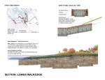
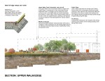
Is part of the larger Water mitigation as the edge of 1 and 3, 4, and 5 are the outlet of both water runoff and formerly the site two creeks/streams that terminate in the bay. With the low lying topography and risk of flooding these prime locations for water mitigation paired with public recreation and education.
Team: Lead Catherine Ann Somerville Venart (Architekten, urban designer), Robert Collins (Ecologist), Julie Jano (designer), M.Arch Students – Holly Simon and Kevin Lou